Sunny north and cloudy south as Super El Niño defines South American winter
- Share
- publisher
- JFN
- Issue Time
- Sep 11,2026
Summary
Super El Niño drove a sharp north–south irradiance divide across South America in winter 2026, with sunnier conditions in the north and persistent cloud reducing solar irradiance across much of the south. Two rare August snowstorms in Chile’s Atacama Desert also caused likely snow-related losses for solar PV assets, alongside severe rainfall, flooding, and mudslides.
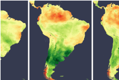
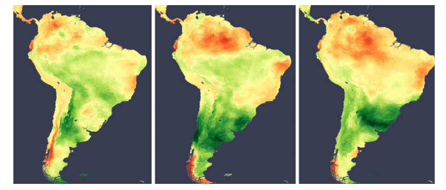
This year’s escalating super El Niño produced a clear north-south divide in South American irradiance during winter 2026, according to analysis using the Solcast API. Northern areas were generally sunnier than usual, while persistent cloud reduced irradiance farther south. Separately, two rare August snow events in the Atacama Desert created likely snow- related losses for solar assets in the region.
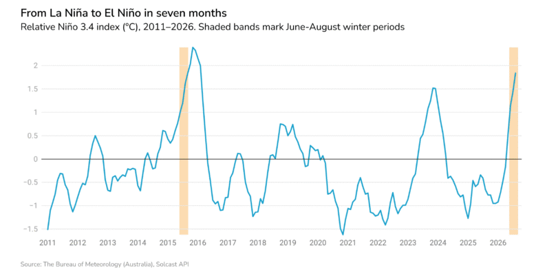
The winter pattern was broadly consistent with conditions typically associated with El Niño in South America: drier weather in the north and wetter weather toward the south. Southern Brazil, Uruguay, Paraguay and northern Argentina experienced the wetter conditions associated with the event, although these effects more commonly emerge later in the year. El Niño was officially declared by several national weather agencies at the beginning of winter, with NOAA declaring the event on June 11 and Brazil’s Instituto Nacional de Meteorologia including it in its June bulletin. It has continued to strengthen rapidly, recording the fastest rise in the Relative Niño 3.4 indicator on record.
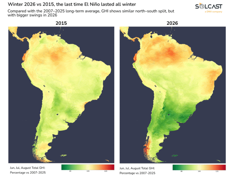
In comparison to 2015, the last time we saw El Niño for all three months winter, 2026 has a much larger deviations from normal with both greater irradiance losses and gains across the continent which may be the result of the stronger El Niño this year. Broad patterns remain the same however with lower than usual irradiance in most of Argentina, Chile, Paraguay and Uruguay, and sunnier conditions in northern Brazil. In contrast, 2026 was more uniformly sunnier in the northern part of the continent and gifted eastern Brazil with some extra sun.
Snow first reached the Atacama Desert shortly before mid-August. Around 20 August, a cutoff low brought a second round of snow. That storm also produced intense rainfall elsewhere in northern Chile, with some areas receiving multiple years’ worth of rain over several days. The resulting mudslides and flash flooding prompted the Chilean president to declare a state of emergency.
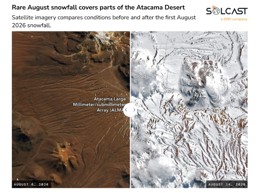
Modelling for a representative 100 MW PV plant in the Atacama Desert shows how the two snowfall periods would align with estimated snow-related losses during August.
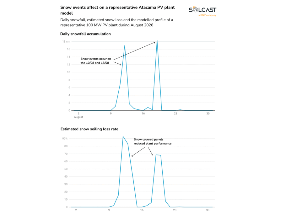
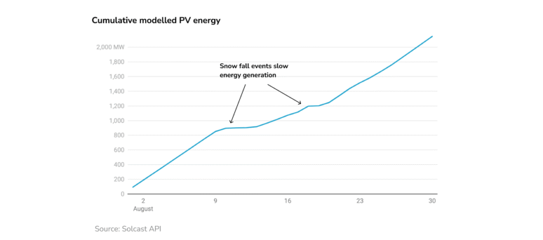
The north-south contrast strengthened through winter, with similar patterns of above- and below-average irradiance in July and August. La Costa recorded the largest positive anomaly after three consistently sunnier-than-usual months, with some areas finishing more than 30% above average. Persistent cloud left most of Argentina 15% to 20% below average. Brazil was more mixed, although northern and eastern regions ended the season sunnier than average, while all but the south recorded above-average irradiance in August.
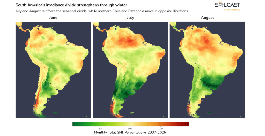
Chile did not follow a single pattern. Northern areas moved from a sunnier June to cloudier conditions in July and August. Chilean Patagonia moved in the opposite direction, with sunnier conditions in both months as Super El Niño disrupted the usual westerly winds that bring moist air into the region.